

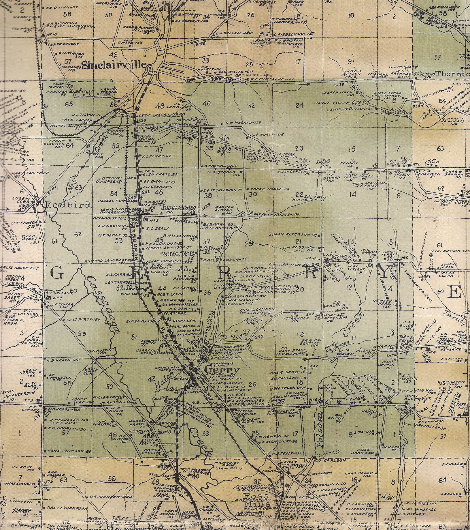
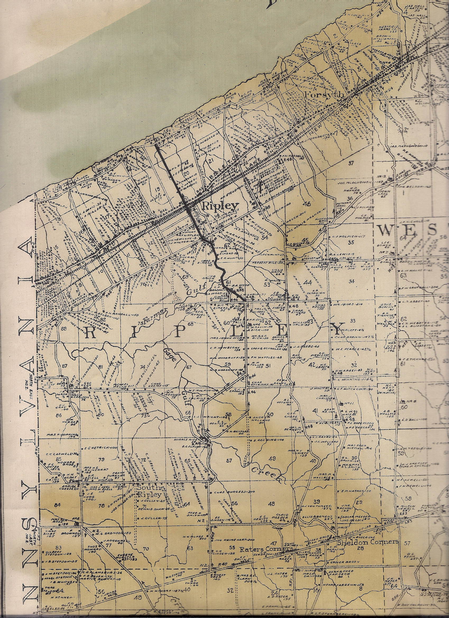
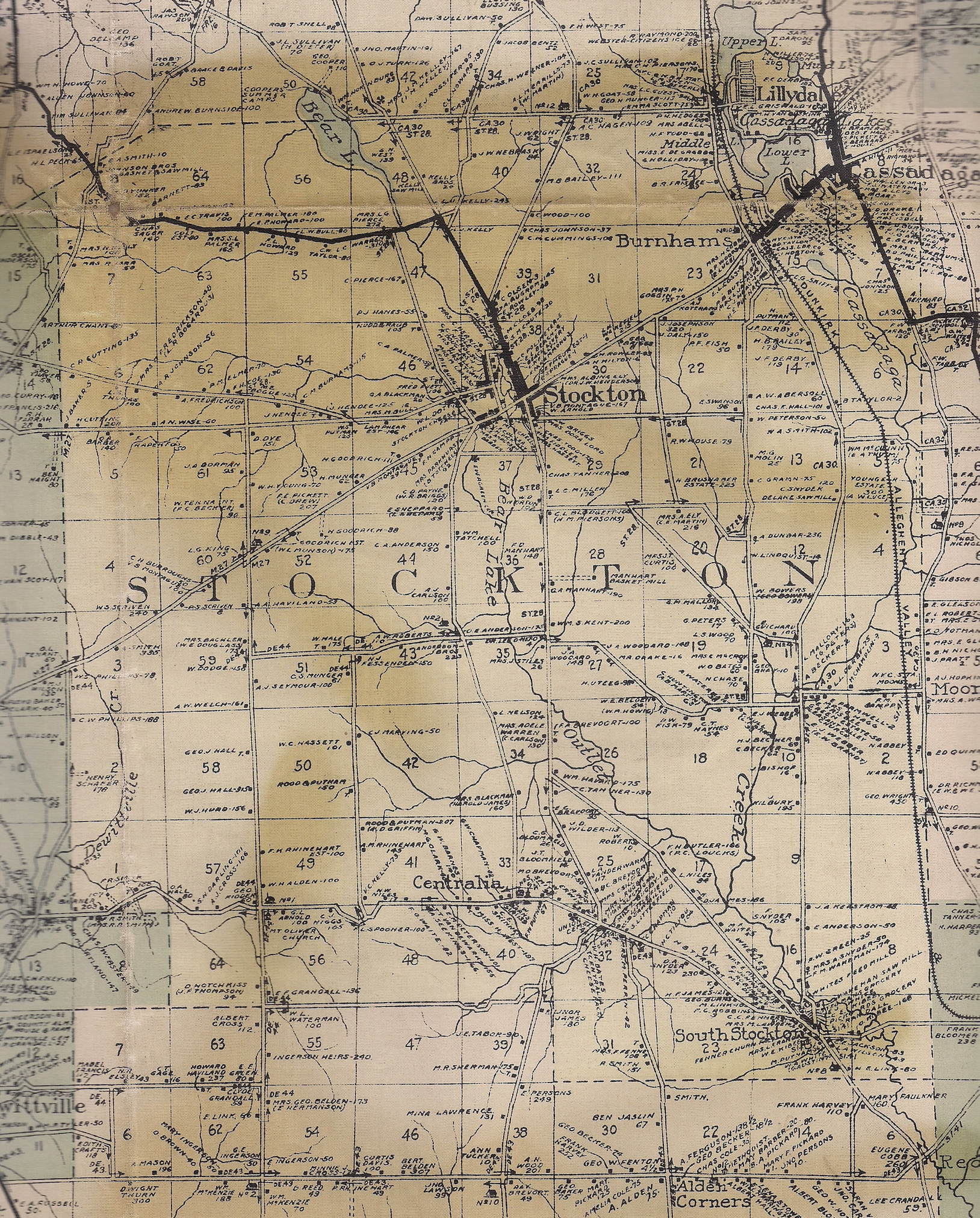
This 1916 wall map of Chautauqua county was contributed by Homer and Violet Sackett, and is now in the possession of Wendy Straight, who scanned the map.
The scans of this map are broken up into townships. Click on a township on the county map below to view the township's map. Alternatively, use the text links below to view the maps. File sizes are in the 0.4 to 1.2 MByte range.
Southern part of Chautauqua Lake